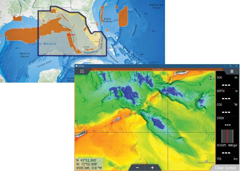
C-Map has released its new Reveal charts, featuring ultra-high-resolution bathymetric imagery of select coastal and offshore areas, including crisp views of structure, wrecks, isolated reefs and ledges between the contour lines. The detailed Reveal imagery replaces shaded-relief data in select areas with more-accurate depth variations. The charts also feature C-Map HRB Coastal Data, Genesis layer social map data and satellite imagery. Available for use on Lowrance and Simrad chart plotters (excluding Hook2 and Cruise), the initial chart offerings cost $299, and cover select Florida and Gulf Coast regions.


")


