Advertisement

SiriusXM Fish Mapping

Satellite weather and music provider partners with Garmin and Maxar to provide key fishing data well offshore.

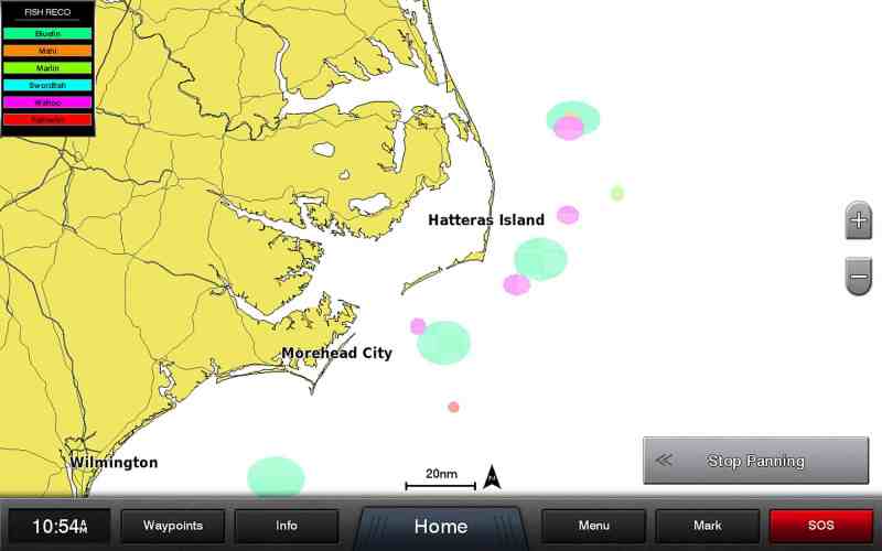
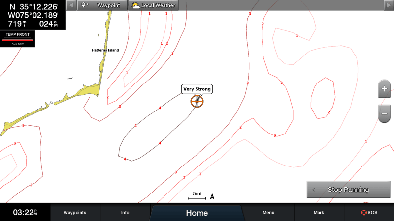
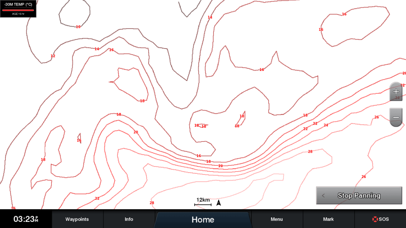
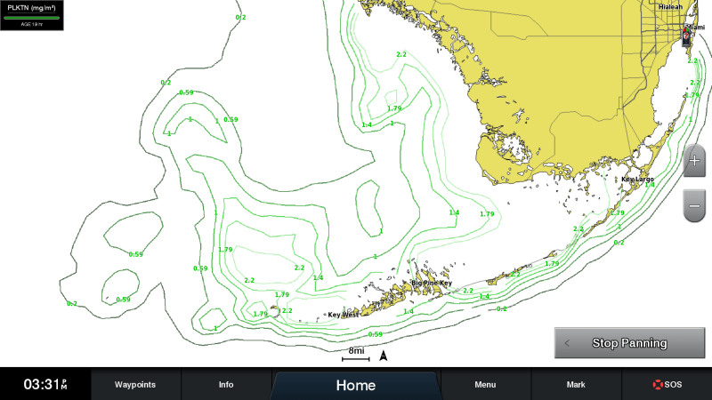
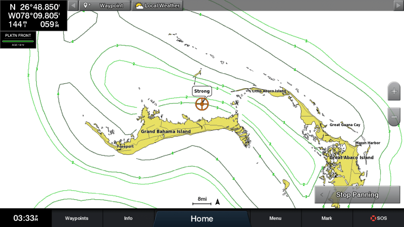
SiriusXM announced this month the launch of Fish Mapping, a service to help saltwater anglers locate fish faster and more effectively. Fish Mapping is currently only available via the Garmin GXM 54 satellite weather and radio receiver, compatible with many Garmin multifunction displays.

Powered by Maxar Technologies, Fish Mapping provides regularly updated, science-based infographics to anglers well offshore, beyond cellphone range. SiriusXM says Maxar has provided oceanographic data and fishing recommendations to commercial fishermen for more than 20 years.

“We are extremely pleased to team up with Garmin and Maxar for the launch of this game-changing new service,” says Dave Wasby, vice president of SiriusXM’s Aviation, Marine, and Music for Business. “With Garmin’s GXM 54 receiver, anglers can view graphical fishing information directly on the boat’s display. The images are refreshed automatically, without customers needing to initiate a new data request. This easy-to-use service will help anglers identify where game fish are likely to be biting – saving time to reach the best spots for a good day of fishing.”

Advertisement

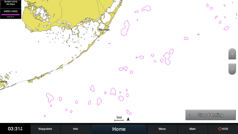
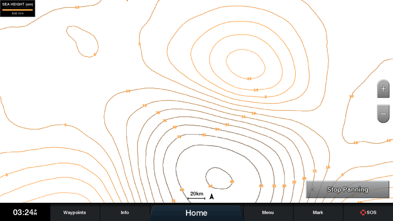
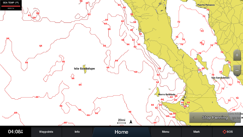
SiriusXM lists the following Fish Mapping features:

SiriusXM Fish Mapping Fishing Recommendations
Fishing Recommendations: View locations oceanographers recommend to find specific types of game fish, based on their expert analysis. The locations are overlaid on the angler’s chart and can be viewed in combination with other features. Courtesy SiriusXM
SiriusXM Weed Lines
Weed Lines: View concentrations of floating algae/plants, which provide nutrients and cover, creating habitats for baitfish, shrimp, etc., and attract predatory game fish. Weed lines drift and shift over time, so they can be hard to locate. This feature shows anglers where weed lines have been sighted recently, or are most likely to be forming. Courtesy SiriusXM
Sea-Surface-Height Anomaly
Sea-Surface-Height Anomaly: View locations where the sea-surface height is different than the surrounding area, using actual radar data and models of the sea surface. Shows “upwelling” areas that create favorable conditions including nutrient-rich water that attracts bait fish and game fish—and helps avoid “downwelling” areas that are nutrient poor and don’t support favorable fishing conditions. Courtesy SiriusXM
Sea-Surface-Temperature Contours
Sea-Surface-Temperature Contours: View contour lines where there is a sea-surface temperature change from cool to warm that attracts bait. These contours help locate target species based on their preferred temperature range. Courtesy SiriusXM
Sea-Surface-Temperature Front Strength
Sea-Surface-Temperature Front Strength: View strength of ocean “fronts,” which are significant temperature changes that create distinct boundaries between bodies of water, concentrating nutrients, which attracts bait. Strong fronts are good places to find game fish. Courtesy SiriusXM
30m Subsurface Sea Temperatures
30m Subsurface Sea Temperatures: View the water temperature 30 meters below the surface. This feature identifies areas with the preferred temperature range of target game fish in the area below the surface where they are likely to be hunting. Courtesy SiriusXM
Plankton-Concentration Contours
Plankton-Concentration Contours: View areas of plankton concentrations. Plankton is the primary food source for most bait species. Courtesy SiriusXM
Plankton Front Strength
Plankton Front Strength: View areas of greatest plankton concentrations with murky, nutrient-rich water favorable for attracting baitfish that are next to areas with relatively little/no plankton with clear, predator-preferred water with better visibility for hunting. Courtesy SiriusXM

With a clear line of sight to the sky, Garmin’s GXM 54 provides the best possible reception — even on the edges of SiriusXM’s coverage area. SiriusXM and Garmin have teamed up to offer $250 in combined rebates on the GXM 54 receiver. For details visit: garmin.blogs.com/promotions/2019/08/2019gxm54rebate.html.

Read Next: Choosing Electronics for Offshore Fishing

Advertisement

The Fish Mapping subscription costs $99.99 per month plus applicable fees and taxes. In addition to the eight new fishing features, it includes all of SiriusXM’s weather information from the SiriusXM Marine Offshore Weather package. The subscription can be suspended at no charge for up to six months each year. For more information, visit siriusxmcommunications.com/fishmapping/.

Advertisement
Advertisement