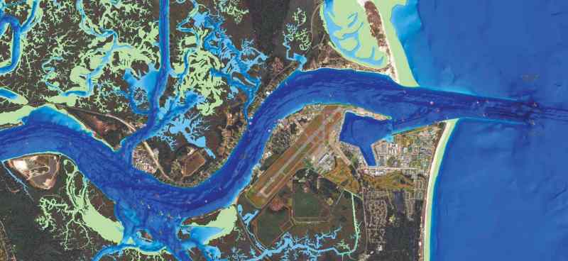
Navionics SonarChart Shading, a new feature for Platinum+ charts, provides a satellite-overlay content layer for detailed rendering of the seafloor. Created from high-definition 1-foot contour data, Shading shows depth changes and highlight channels, drop-offs and other underwater topography. SonarChart Shading is compatible with all plotters that currently work with Platinum+ satellite overlay and offers the same viewing options. At closer zoom levels, Shading is replaced by the satellite imagery, allowing boaters to see a bird’s-eye perspective of sandbars and backwaters. Prices range from $199 to $399; it’s free for current chart owners with Daily Updates subscriptions (other discounts may apply).

")