If you’re preparing for a tournament, considering a Bahamas crossing, or searching for a hot spot in a wide-open ocean of options, one piece of electronics — that you might never have tried — could swing the trip for you: PC planning software.
Even if you’re not a gadget guru, chances are pretty good you own a PC, or even two. And even if you’re not a whiz at picking up new computer skills, if you own a boat, you’ve looked at charts.
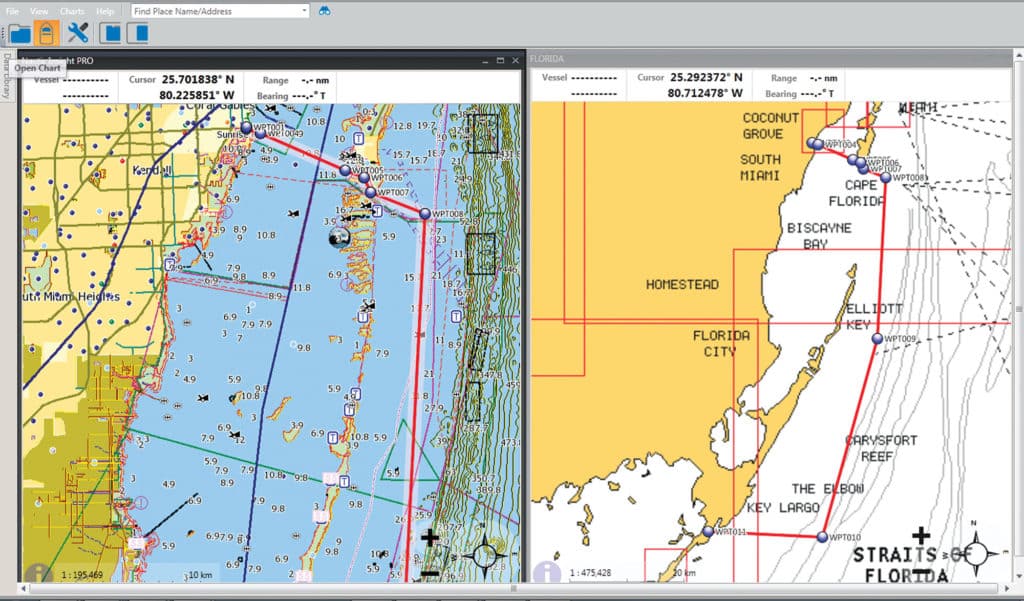
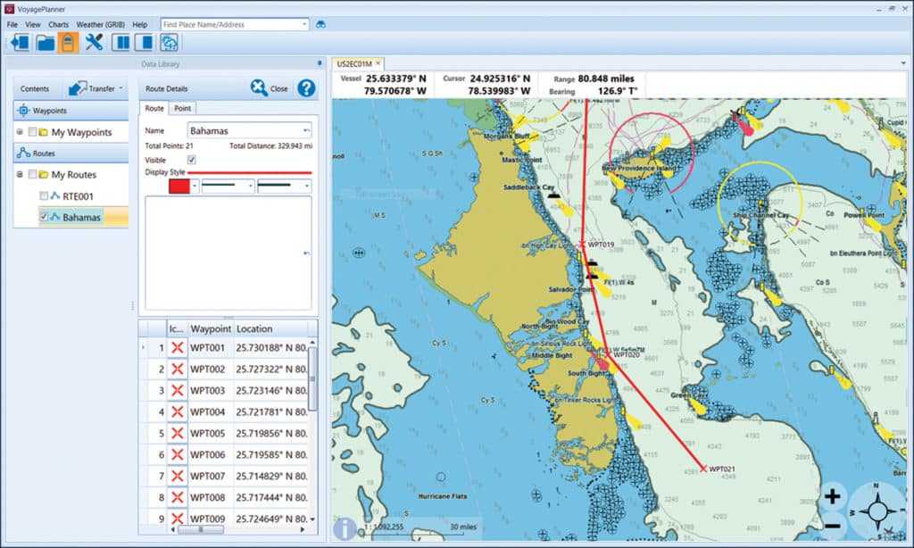
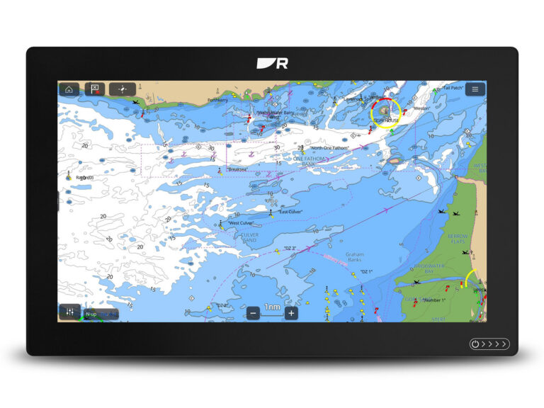
PC planning software provides charts, and in some cases information or data overlays, so you can create routes; study contours, weather and sea-surface temperatures; and save thousands and thousands of waypoints — all with the speed and ease of a PC. Some software programs — such as Raymarine Voyage Planner, Garmin HomePort, Navico Insight Planner and HumminbirdPC — primarily reside in your PC at home. Data can be transferred via SD card to your onboard plotter.
Others, such as Nobeltec TimeZero SportFishing and Fugawi Marine 5, can go from your home to your boat via your laptop, where the programs can be used to navigate your vessel to its destination.
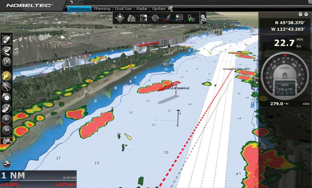
If your vessel features an enclosed bridge, you can easily create a weatherproof environment. You can then use the software to interact with your onboard systems — autopilot, AIS, sonar, GPS, engine instruments — using the NMEA 2000 and NMEA 0183 networks. If you have a marina Wi-Fi connection, you can download weather data at the dock to make last-minute changes.
Full Functionality
Yes, myriad apps for smartphones and tablets have created mobile options for anglers with all boat sizes. But, according to Fugawi, those apps have simply brought more opportunity to boaters rather than eroding the PC planning-software market.
“We’re not finding our users are abandoning Fugawi for apps,” says Robin Martel, president of Northport Systems, which makes Fugawi products. “Boaters have gone from not using anything to at least using something.”
For many boaters and anglers, an app might be sufficient. But for boaters who want the capability, screen size, speed and power of a PC behind their planning and navigation, full-blown software can be the way to go.
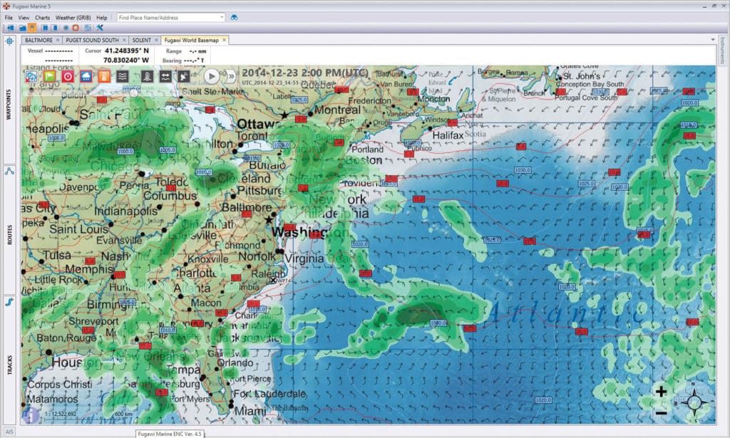
Martel says anglers who use Fugawi Marine 5 buy it for three major reasons:
- Data management. Longtime anglers and captains sometimes store tens of thousands of waypoints, routes and tracks. Fugawi offers “an almost commercial-grade database” in the background to handle that information. The software allows anglers to drag and drop information and import or export waypoints in a variety of ways, seamlessly.
- Multiple-chart format. PC-based software supports the widest variety of chart formats out there. Fugawi supports NOAA ENC/RNC, BSB charts, all post-2010 Navionics cards and a wide variety of other charts via the Fugawi X-Traverse chart service.
- Boat operation. Fugawi supports numerous instruments and gauges using NMEA 0183 and NMEA 2000, so captains can see everything they need on the laptop screen or monitor.
Aboard your boat, a PC’s speed makes virtually everything easier. “With a mouse you can click very fast,” Martel says. “It’s easier to drop waypoints on a PC than on the embedded electronics on a boat.” Fugawi Marine 5 costs $299, and updates are free.
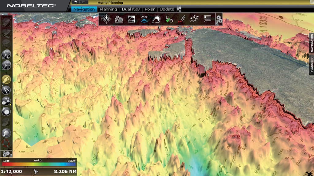
Nobeltec’s software is exclusively compatible with Furuno multifunction displays and radars, although it can network with some stand-alone NMEA 0183/2000-capable AIS, GPS and sounder modules. The package ($1,650) comes with the TimeZero chart engine, NOAA raster and vector charts with satellite photos and 3-D data, a Bathy Recorder for building your own bottom contours on charts, a radar pack, and OCENS weather-forecast data.
“You’re using a full-blown computer CPU (central processing unit), which has amazing graphics, that’s best known for its speed and graphic quality. You can have multiple screens on deck. You can have radar on one, a plotter on another, a sounder on another, and do your route planning on another,” says Terry Crockett, Nobeltec’s western regional sales manager. “There’s also the cost efficiency: For $400, you can get a CPU and you’ve got a full-blown multiple-screen MFD-type system.”
With the Bathy Recorder, anglers can record sonar logs for any area and save that data. It can then become a layer you enable along with your route and waypoints on the screen.
“I could go back to my 2013 Key West Shootout tournament data, and turn on the Bathy and marks so I could see where we caught bait, where we hooked up. I can selectively bring up that info on the screen,” Crockett says.
Primarily Planning
Raymarine, Navico (Simrad and Lowrance), Garmin and Humminbird all offer PC software for waypoint storage and trip-planning purposes. Data can be stored on a USB drive and transferred to compatible onboard multifunction displays. Each company’s software is obviously compatible only with its branded units.
“[Raymarine] Voyage Planner is a very basic PC-based planning product that allows you to plot waypoints, build routes, and organize and create waypoint groups,” says Jim McGowan, Raymarine marketing manager. “With an optional subscription to the Theyr Premium weather service, it also has the ability to download and overlay GRIB weather data and sea-surface temperature charts.” (Subscriptions start at $14.99 per month and are available in Raymarine’s Voyage XChange online store.)
Voyage Planner offers point-of-interest data only if the information comes with the maps used (Navionics and NOAA ENC charts support POI). However, Voyage Planner is not compatible with online services such as ActiveCaptain. It does allow you to share your data via Facebook, and it supports the GPX file format — a generic way to store coordinates.
“We realize that there’s a huge audience using all kinds of planning software. The GPX import/export capability found in Voyage Planner and all of our multifunction displays makes it easy to share that info in and out of the Raymarine system,” McGowan says. “Voyage Planner can also import and export KMZ files, native to Google Earth. So if you’re wanting to follow the edge of a reef or getting onto the flats, you can freely bring data back and forth between Voyage Planner and Google Earth.”
Navico’s Insight Planner imports and exports in a proprietary company format so everything stays the same, from the software to the plotter, including any customized icons.
“What anglers really like is the waypoint management,” says Michael Kaste, digital marine program manager. “You can group things, and clean up the waypoints on the PC. It runs faster and the screen’s bigger. You can do all your customization work on a PC, then export it out and put it on the boat.”
These simple planning programs range in price from free to about $50, so they’re worth exploring. “In the early days, everyone was using CPUs. Then we went to MFDs, and the PC software sort of wasn’t recognized. But we’re seeing a huge trend back to it,” says Crockett. “With the cost of laptops dropping, people are realizing how good it is and what it does with the broader reach of Internet connectivity.”