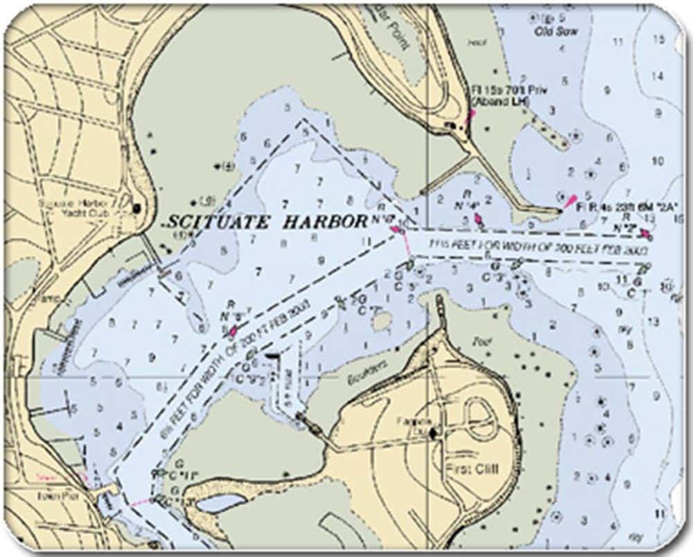
NOAA nautical charts
The nation’s coastal-surveying office announced Tuesday that it will stop printing traditional paper nautical charts starting April 13, Boating magazine reported. NOAA’s Office of Coast Survey will continue to provide other forms of charts, including print-on-demand charts and versions for electronic charting systems for plotters and PCs.
NOAA had printed those lithographic nautical charts since 1862; they were commonly sold in marine and ship’s stores. The agency cited declining demand for the paper charts, increasing use of electronic charts and federal budget realities.
Boating reported that NOAA plans to introduce full-scale .pdf nautical charts, which are available for free download right now on a trial basis at nauticalcharts.noaa.gov/pdfcharts.
NOAA’s Office of Coast Survey is the nation’s nautical chart maker. Originally formed by President Thomas Jefferson in 1807, Coast Survey updates charts, surveys the coastal seafloor, responds to maritime emergencies, and searches for underwater obstructions that pose a danger to navigation. Follow Coast Survey on Twitter @nauticalcharts, and check out the NOAA Coast Survey blog at noaacoastsurvey.wordpress.com for more in depth coverage of surveying and charting.