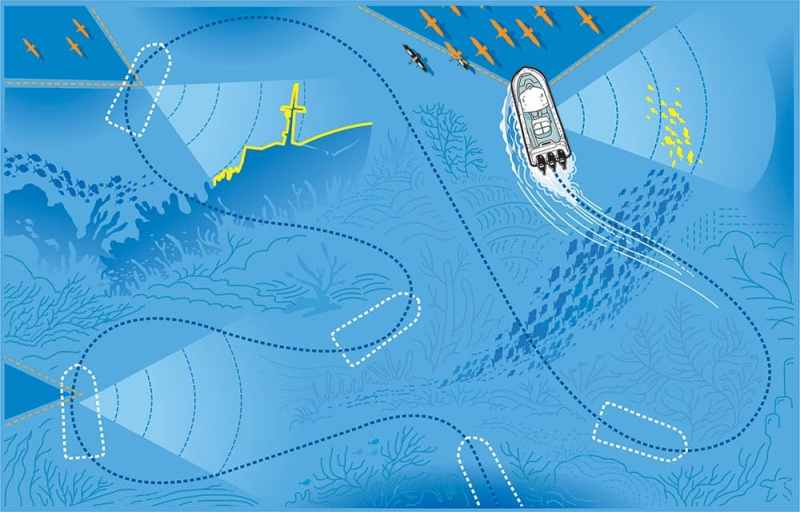
Search Engines
I know that asking anglers to stop fishing and start searching for new structure is about as sacrilegious as flag desecration. Being on the water is precious, but prospecting should actually save anglers time in the long run, plus you can do it when the bite lags or during slow seasons.
“Prospecting is a difficult habit for saltwater fishermen. Freshwater-tournament anglers have this down to a science,” says Capt. Shaun Ruge, who runs Riptide Charters in Massachusetts. If you always return to the same locations, “you may be setting yourself up for disappointment. Worse yet, you don’t learn anything with easy repetition.”
Search Engines
In fact, says south Florida Capt. George Mitchell, in years past, prospecting was really the only way to fish. “Way back when, we had only a compass, watch and landmarks; we had to ‘find stuff.’ Sure, there were a few known locations, but most of the time, we’d drift an area while looking at the paper recorder. If we got a bite, we’d take note of the landmarks,” Mitchell says.
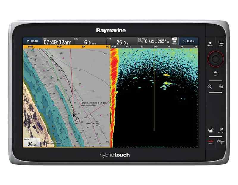
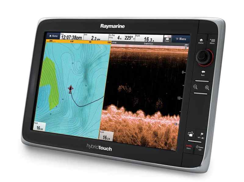
Mitchell, who uses Furuno electronics, and Ruge, who runs Raymarine gear, employ not only sounders, but also plotters, radars, AIS, and autopilots to create systematic, time-effective prospecting strategies. And while they do search for permanent ocean fixtures, they also investigate temporary structure such as anchored ships and bait schools. They and four other captains, pro anglers and brand experts agreed to share their tips.
Sounder Tips
“When I’m running, I always dial in and watch the bottom machine. I find all kinds of stuff,” says Bill Platt, a Garmin pro-tournament fisherman out of Texas. “A lot of times, I run over a little piece of structure. I turn around and spend maybe 15 minutes looking. I might find the whole structure — maybe even the mother lode.”
“Anytime I’m anchoring in deeper water, I always have my StructureScan on and set to 80 feet,” says Florida Keys captain and TV host Tom Rowland, who uses Lowrance HDS 12 units. “I have found pieces of wrecks that have broken away that hold better fish than the main part.”
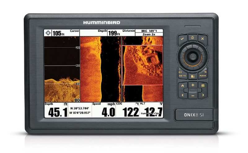
Side Imaging helps determine exactly how rubble or a wreck lays on the bottom, says Bill Carson, Humminbird marketing product manager. “This allows the captain to drop waypoints for a wreck to include bow, stern, and sides, providing pinpoint accuracy for dropping on the structure with wind and water movement.”
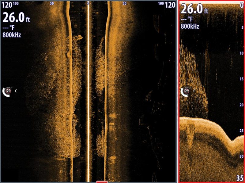
“While fishing for striped bass and bluefish along the shoals, I zigzag the drop-offs to find where fish are holding along a piece of structure that might stretch for a mile,” Ruge says. “A small pile of rocks can be an oasis in the sandy desert around Cape Cod. I will drop a waypoint, and then go back on a day when sea bass or fluke are my targets.” Ruge adds that he uses CHIRP (CP450) and DownVision to prospect new spots — at up to 30 mph. “Sure, I get better detail at slower speeds. But at higher speeds, I am looking for different signs. I’m looking for larger, more-obvious signs of life.”
Search Engines
Radar Tips
One trick is to turn on radar and look for the local charter guys. “They’re usually on top of each other,” says Capt. Mike Smedley, who charters out of Youngsville, North Carolina, and uses Simrad evo2 and NSE systems. “Then go in and look for bait with StructureScan.” With StructureScan, Smedley says he can also keep an eye on the bait school as it moves because the cone reaches 200 feet left and right.
“I run radar all day long,” says Ruge. “More often than not, a flock of birds pops out of nowhere, and the grass immediately becomes greener three-quarters of a mile away. “Keeping an eye on radar is prospecting beyond what the eye can see — sort of multitasking in another dimension. This also lets me adjust my hunting pattern. Now I know that some fish are setting up deeper. If this pattern repeats, I can adjust the depth at which I hunt with sonar. I started shallow — maybe it is time to look deeper?”
Using Other Marine Electronics
“Let’s say you’re out for a summer day of dolphin fishing off the east coast of Florida,” Mitchell says. “You can set your autopilot to follow a general depth contour, and then set your bottom alarm to reflect either a drastic depth change or fish.”
Mitchell also says that when he fishes for wahoo, he creates a zigzag route on his plotter based on his target area. He sometimes runs the route with his autopilot, but he usually changes the path slightly on the second pass.
“I use my electronics to display aerial-photo overlays and to study the areas closely,” says Rowland. “I often find things I was not aware of and might have overlooked.”
“Sometimes I find drill ships out of Venice with AIS,” says Platt. “Drill ships generally stay in the same place for a long time. I can drag around them for marlin and tuna.”
“Before I even get to the boat, I review bathymetric charts, using Navionics SonarCharts, to find drop-offs and depth changes,” says Ruge, who also works for Navionics. “I select them with general knowledge of fish habits at certain times of the year. On the boat, I program a few waypoints and then start hopping from -structure to structure.”
Captains I spoke with all agreed that prospecting keeps anglers in the fish. Today’s electronics make the job so much simpler by providing high‑definition, accurate and versatile tools.


