The aptly named fish finder ranks at the top of every angler’s list of necessary electronics. But where does the chart plotter fit in that high-tech hierarchy?
In the past, plotters helped anglers efficiently find the fishing grounds, and little else. But these days, using tracks, routes, waypoints, overlays, trolling-motor connectivity and sonar-logging features, plotter charts become more like treasure maps, leading anglers to optimal fish and bait concentrations.
Pro fishermen and charter captains liken plotters to computers. Here’s how five of them use their units to find and catch more fish.
Plotter and Trolling Motor Connection
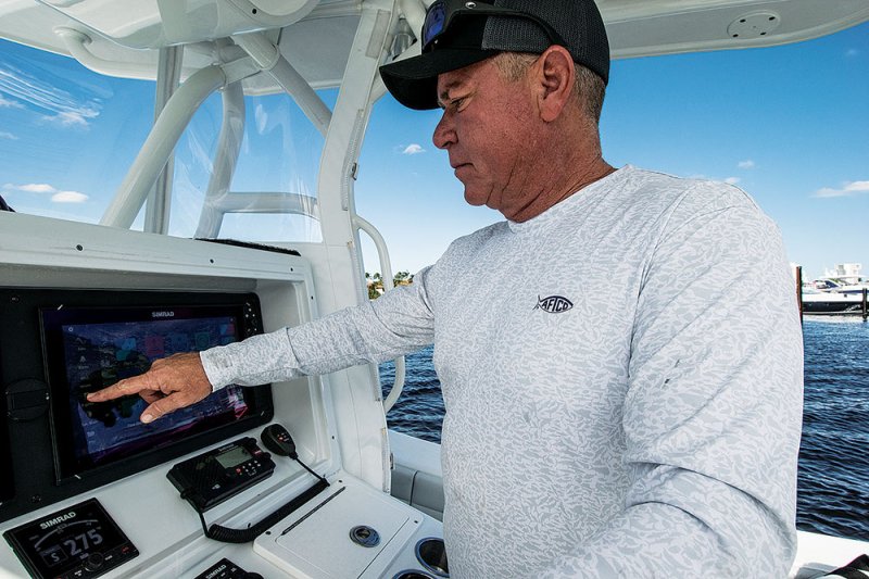
“I think of my boat as my office and my plotter as my office computer, and everything I need is on there,” says Capt. Phillip Wilds, who runs Anchored Charters Guide Service out of Panama City, Florida. “I need the bottom machine to see the fish, but as far as making things efficient, it’s the chart plotter.”
Wilds operates two Humminbird Solix 12 multifunction displays aboard his Barker 26 Open, which is equipped with a Minn Kota iPilot Riptide Ulterra trolling motor. He runs his trolling motor from his Solix, marrying the capabilities of both to maximize his inshore fishing trips.
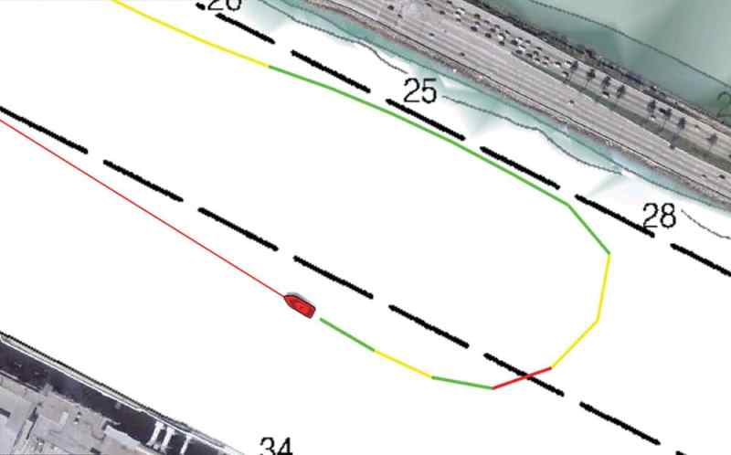
“One of the greatest things is to have the plotter plot a track and then fish back through it,” he says. “It’s going to take you on your exact trail back through the fish, and you don’t have to do anything except fish. “If you want to work an edge or a ledge, you can set it to work a contour line and stick to a certain depth.”
When fishing offshore, Wilds uses tracks and the Minn Kota’s SpotLock to see the boat’s relationship to the structure he’s fishing and to stay on that structure. “Up here in the Panhandle, there are a lot of spots I fish that aren’t much bigger than a coffee table,” he says.
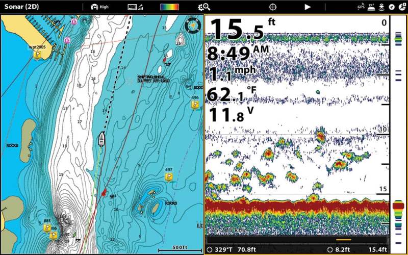
Use Tracks to Pattern Fish
Capt. Terry Nugent, who runs Riptide Charters out of Cape Cod, Massachusetts, says he never leaves the dock without the tracking turned on for the Raymarine Axiom Pro 12 display aboard his HydraSports 22 LTS. Nugent targets stripers, chasing them under the birds in run-and-gun fashion. “Tracks allow me to see the direction the fish are trending at any time. Whenever we find bait or a bunch of birds on the water, or if we’re trolling and get a knockdown, I drop a waypoint. You’d be stunned by how that builds a picture for you.”
Nugent deletes his tracks at the end of June, once the striper bite fades. During fall, he tracks tuna on his offshore boat. “Some years, they’re in 250 feet; some years, they’re more focused in about 120. Over the course of a week or two [with tracks on], you can see that maybe they’re focusing between 120 and 150 feet. It becomes apparent.”
Because he targets migrating fish, he does a master reset on his Raymarine at the end of each fishing year. Other captains, particularly those who tournament-fish or bottomfish for species such as snapper and grouper, religiously catalog their points and tracks on SD cards by region. Or, like Wilds, they organize them on their MFDs by location, depth, federal/state water areas or other factors.
Keep and Catalog Plotter Tracks for Future Use
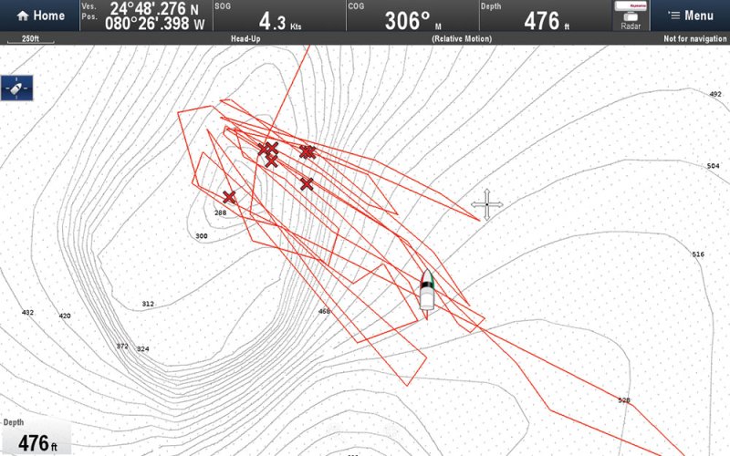
“I’ve got tracks for 10 years,” says tournament captain Mark Maus, who runs his Yellowfin 36 — equipped with Simrad NSS evo3s and NSO evo3s — out of Sarasota, Florida. “I download everything to cards, and then I isolate my stuff to two areas.”
Maus uses tracks to troll for a variety of species and to help him navigate back to unfamiliar locations. He also employs Simrad’s TrackBack feature on his sonar to enter waypoints when he sees something new. Simrads display seven full screens of TrackBack history for anglers to scroll through. Touch the sonar screen or the main input key, and a waypoint automatically drops onto the plotter.
When targeting white marlin, Maus says, tracks also come in handy. “White marlin run in wolf packs. If we hang a white, and it takes 20 minutes for us to get it to the boat, I can go back, based on the track, and hang another one. There’s no reason to drop a waypoint to save for later because they’re moving.”
If he’s pre-fishing an area for sails, he might mark 20 or 30 waypoints where he found bait. The next day, though the bait will have moved, Maus says he’ll run-and-gun the points because “something will have held bait in those locations.”
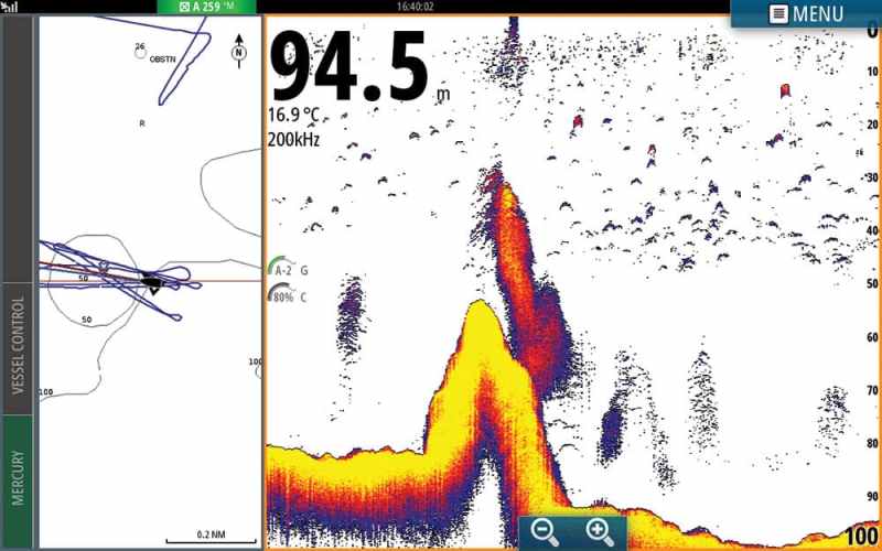
Changing Track Colors Based on Temperature
Capt. Greg Shute fishes much of the Chesapeake Bay out of his 27-foot Judge. He uses his Furuno TZtouch2 and 1870 units when he’s drift-fishing for stripers. “Usually, I’ll have a point or something I’m trying to drift over. I set up and drift the first time and can follow a parallel line to the track to make sure I hit the spot again,” he says.
Shute employs several Furuno-specific technologies on his plotter, including a two-finger touch, which automatically drops a waypoint, and a color-changing tool that varies the track’s color with either temperature fluctuations or bottom-type changes.
“I can zigzag over areas while looking for fish and note where the bottom composition changes,” he says. “I will then use where I see the color changes in conjunction with marks I had on the fish finder.”
Shute also changes the actual color of a given day’s track so that he can tell the different trips he has made. By looking at the tracks and waypoints he has used, he can tell where he has fished and where he has caught fish. Normally he deletes the data every two weeks or so.
Hunt and Scout with Waypoints
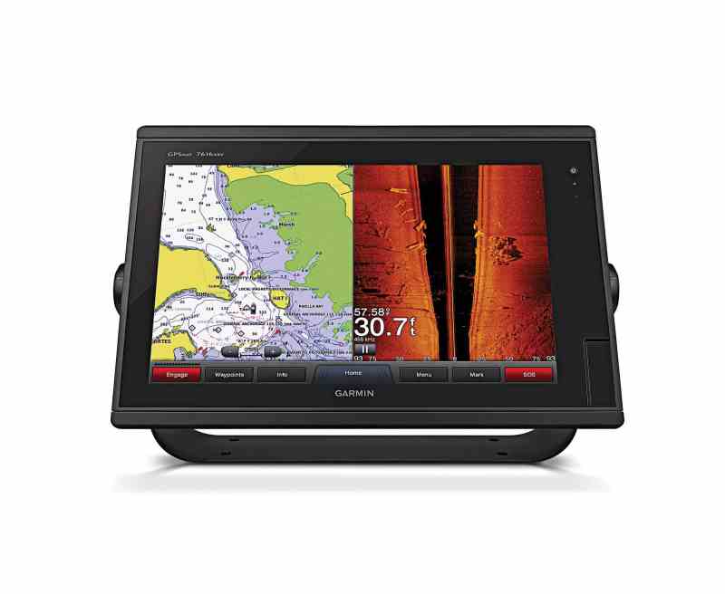
Garmin 7400 and 7600 Series 16-inch MFDs
Tournament captain Bill Platt keeps his data on SD cards based on region. “I can see where I catch fish year after year. The plotter is a computer now, not just a navigation chart.”
Platt fishes a SeaHunter 39 with triple Yamaha 425 XTOs; his boat is equipped with the Yamaha Helm Master system and with three Garmin 7612 MFDs. “A big mistake people make is they pull up at a waypoint and look and see no fish there,” he says. “I start looking around. A lot of times the fish move. If I mark them again, I see which way the current is running and drift past the fish. Then I use a track to come back around and fish them.”
He uses his Helm Master’s Set Point function to stay on the fish and keep the stern to the current. If the fish move, he drifts again and watches his track.
“I find so much stuff looking around my different waypoints,” he adds. “If I run a charter, I go to a spot and I look all around. It’s like finding treasure.”


