Now that smartphones can do everything from report tides to store coordinates, anglers have even more options for adding handheld electronics to their gear bags. But which portable devices really fit your fishing needs, and what do today’s products actually do?
I decided to examine several popular portable GPS and VHF units, and walk through the two primary marine-navigation apps for smartphones. My intent was not to perform an exhaustive study and compare products but to see what’s available for a variety of users.
**
Handheld GPS**
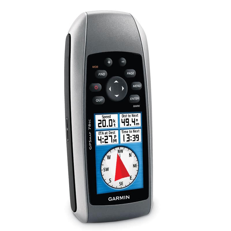
While many companies build handheld GPS units primarily for inland exploring and geocaching, a few marine models do exist. I took a look at the Garmin GPSMAP 78sc ($549.99) to explore its capabilities.
The 78sc comes with a built-in three-axis compass that can show a heading at any speed. Hunt and fish tables provide “best” and “good” catch times daily. Sun and moon rise and set times, barometric pressure and tide charts put important fishing variables at your fingertips.
In fishing mode, you see contours. If you plug the handheld into a compatible fish finder using a NMEA 0183 connection, you’ll get real-time depths as well.
Change to nautical mode, and you’ll see chart depths, buoys, channels, lights and current stations. Adjust the amount of information you see to declutter the screen.
“Find” obstructions, and you’ll see a list of rocks and wrecks, which also appear on the map in nautical mode. In virtually all cases, you can choose to navigate to any point of interest or waypoint from a variety of screens.
You can also quickly measure the distance between two locations or simply point the 78sc at an object, lock the direction and navigate to that spot. If you want to enter lat/lon numbers, use the Find command and click on coordinates.
The device, which floats, supports other Garmin cartography, such as topo and street maps, and can connect with Garmin’s PC and Mac HomePort program for pretrip route planning and post-trip data sharing. Chart updates roll out twice a year and cost about $100.
Handheld VHF
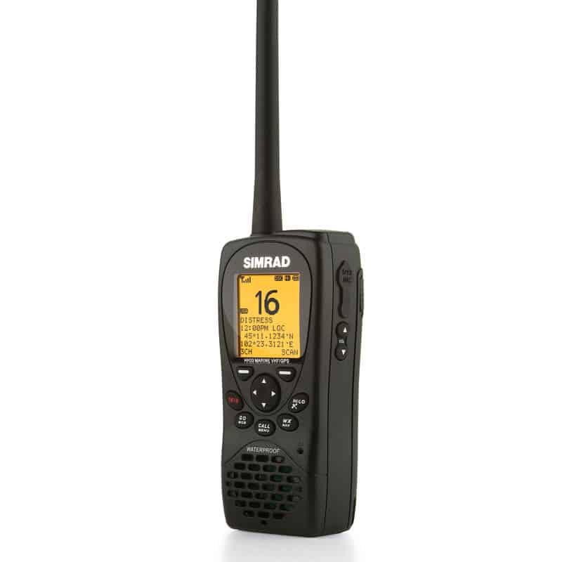
I looked at three handheld VHFs in two categories and price ranges — units on the market at press time. ICOM designed its M24 ($179) for lightweight portability. Standard Horizon’s HX851 ($269.99) and Simrad’s HH33 ($249) come heavily feature-laden.
The attributes I particularly liked about the 5-watt ICOM included its super-light weight at 9.2 ounces. If dropped, it floats and flashes.
If you lock the M24, you can bang around a small boat without inadvertently transmitting. Set up your favorite channels as TAGs and then program them to scan several ways. The dual-/tri-watch feature continuously monitors channel 16 while you receive or transmit.
Other pertinent features: The VHF can signal you with a tone and a blink if NOAA issues a weather alert. You can charge the M24 from a cigarette lighter.
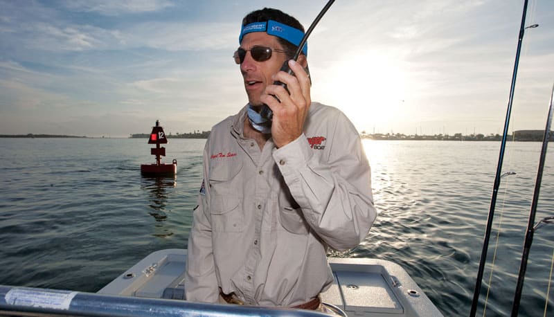
David McLain, ICOM’s national sales manager, points out one main difference between having a dedicated handheld VHF and relying on cell phones on the water: “When you have a VHF, you’re able to monitor for emergencies. If you have only a cell phone on your boat, you might have five other boats around you, but do you have their cell-phone numbers to call?”
The 6-watt HX851 and 5-watt HH33 come with built-in GPS for digital selective calling, position polling and even waypoint navigation. DSC distress alerts reach out to the U.S. Coast Guard and to other vessels, and include your vessel’s position.
Position polling allows anglers fishing a tournament together, for instance, to dial in a vessel MMSI number and request its position. With internal GPS, these units — even with a small display screen — can show that location or any waypoint.
The effective voice-call range of a VHF handheld varies from three miles up to about eight; maximum output power allowed by the FCC is 6 watts. DSC calls from the HX851, generally very short, digital bursts, can reach as far as about five miles, Standard says.
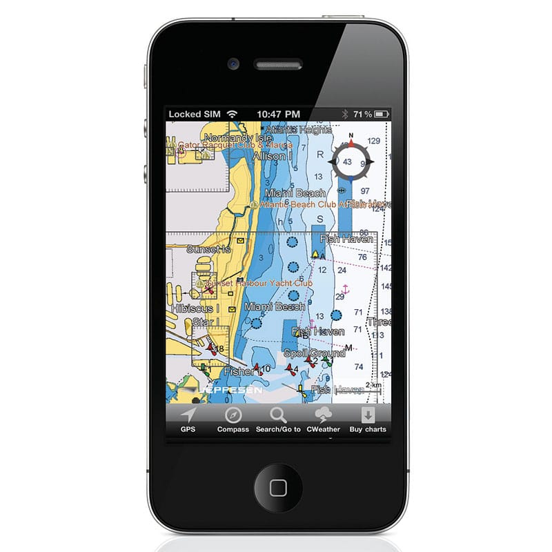
Smartphone
Most prudent mariners agree that while some handheld electronics might be used as primary devices on smaller boats, smartphones should be used only as backups — not for primary navigation. But that doesn’t mean they’re not effective, useful and even fun.
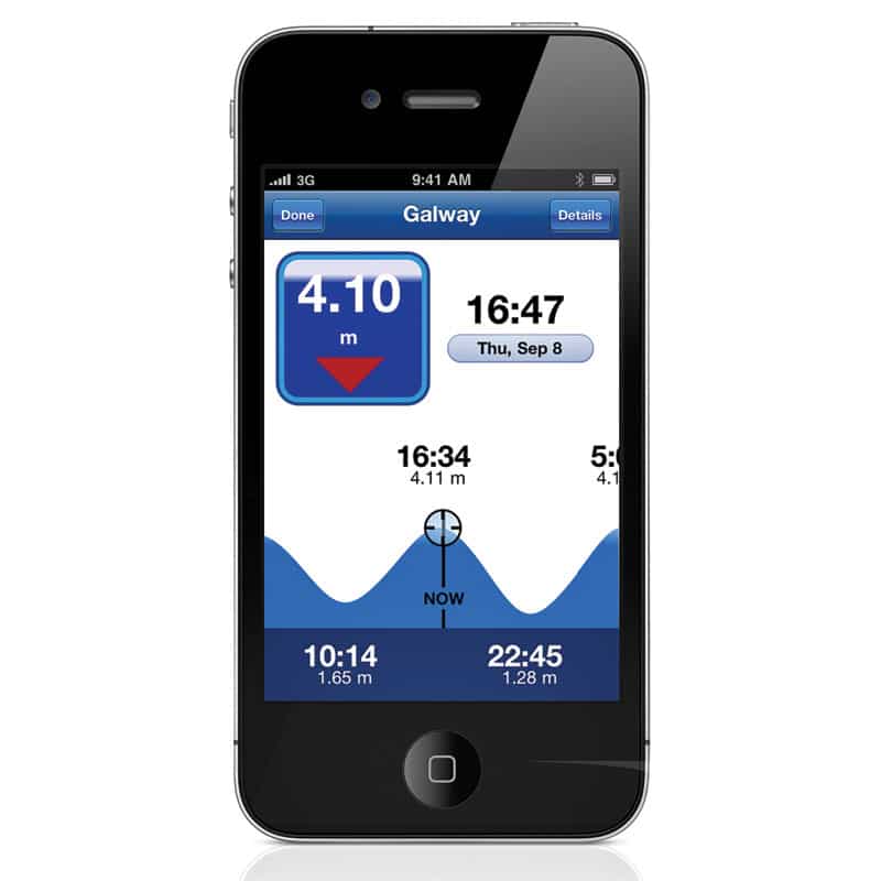
Navionics and C-Map offer mobile marine nav apps that feature pretty fancy functions. These apps work — as long as the data is downloaded — anywhere the phone can find GPS satellites, so their main functions are not limited to cell-tower range.
The Navionics app ($9.99 includes U.S. charts), introduced in 2009, features a constantly updated community layer that lets users include new wrecks, buoys, obstructions and other features. It also offers editorial content from publications tied to destinations and topics such as fishing, plus aerial overlays from Google, Bing and Terrain (when online).
Functions include measuring distances (with course) between two locations, basic routing and tracking. Anglers can also search for a variety of POIs and tide/current data.
C-Map’s just-introduced Plan2Nav is free — with detailed charts at $19.99 to $29.99 per region — and can overlay weather data such as wind speed/direction, wave height, humidity and temperature. It also allows you to tilt the screen for a 3-D view, and supports a go-to function.
So, whether you pack a ditch bag for offshore fishing or need a small unit aboard a kayak or flats skiff, today’s handheld devices give you convenient access to angling and boating information and additional safety.
Simrad HH33
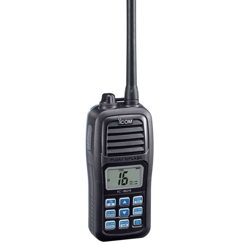
ICOM M-24
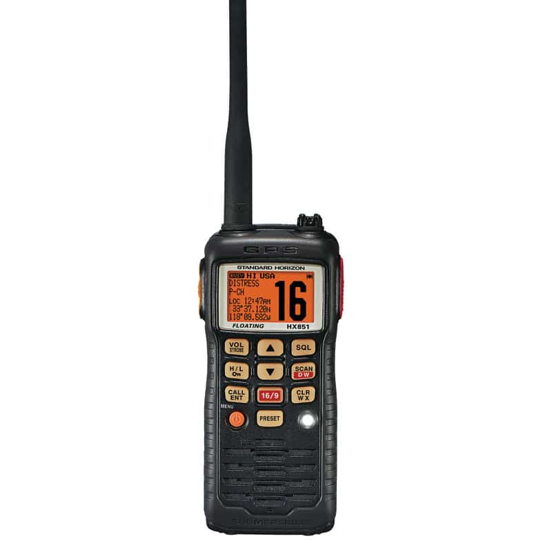
Standard Horizon HX851
C-Map Plan2Nav