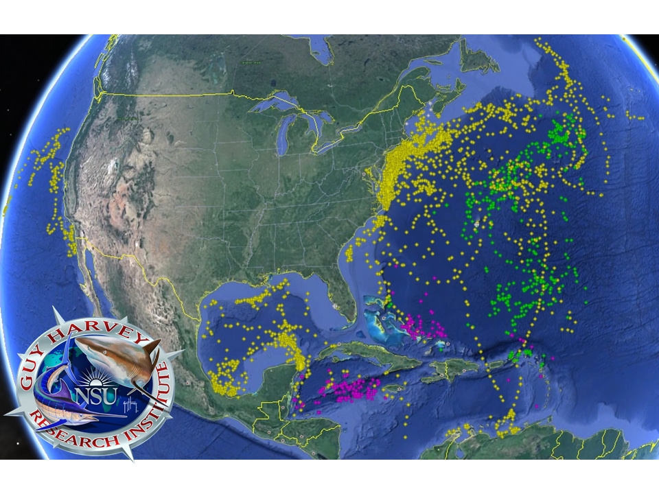
This colorful rendering of a Google Earth view of the western and central Atlantic is remarkable when you realized that each dot on the map is one point during any given day where the satellite tag in a particular shark was recorded during 2015. “That’s quite an accomplishment for the little team of scientists that Guy [Harvey] and Mahmood [Shivji] drag with them around the world,” says Brad Wetherbee, assistant director at the Guy Harvey Research Institute.
While the map shows just one location per day per shark, “Some species actually reported their locations multipled times a day, providing a very high-resolution view of their migrations,” says Shivji.
As to the colors, Wetherbee says yellow dots represents makos, green is for tigers, pink for ocean whitetips and the white dots (barely visible in southwest Florida and Bermuda) are hammerheads, duskies or six gills.
Busy as the map is, the scientist says that if they had added dots to show the tracks of marlin (blues and whites) and the tiger sharks off East Africa, it would be that much more crowded with activity.
“One of the things that has amazed researchers is how far out into the Atlantic the tiger sharks have gone during their migrations compared to oceanic whitetips, which are supposed to be much more pelagic in their behavior than tigers,” says Shivji.
To dig much deeper into species- and area-specific tracking maps, visit Shark Tracking at the Guy Harvey Research Institute.