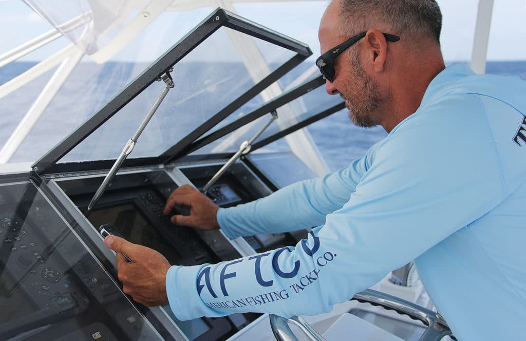
Successful tournament anglers need every edge they can find — from perfectly prepped baits to key ocean and weather predictions. For the latter scientific details, many turn to online and app-based services.
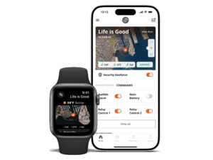
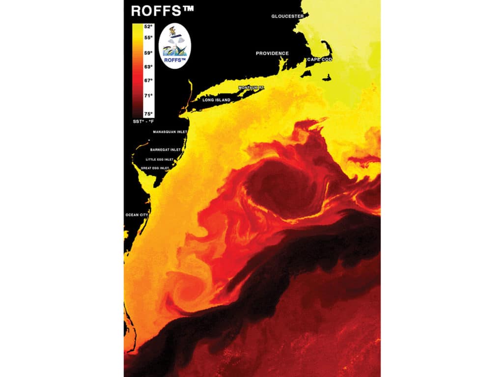
Three of those services with somewhat differing products include ROFFS (Roffer’s Ocean Fishing Forecasting Service, which launched in 1987), Hilton’s Realtime-Navigator (2004), and relative newcomer (2013) FishTrack. These subscription-fee services offer a variety of data and information, from how-to fishing articles and colorful sea-surface-temperature charts to professional oceanographic analyses.
As a result, prices vary greatly — from as little as $70 for a single, one-off ROFFS oceanographic analysis, $200 a year for the first national region (Hilton’s), and $79.95 a year (FishTrack) to as much as $1,500 for multiple Hilton’s national/international regions, and $2,500 for unlimited in-season ROFFS analyses.
To determine the most important features of these services to tournament captains, I asked eight of them from the Gulf up through the East Coast to tell me how they use the information to prepare for events.
Gulf Coast
Capt. Bill Cannan
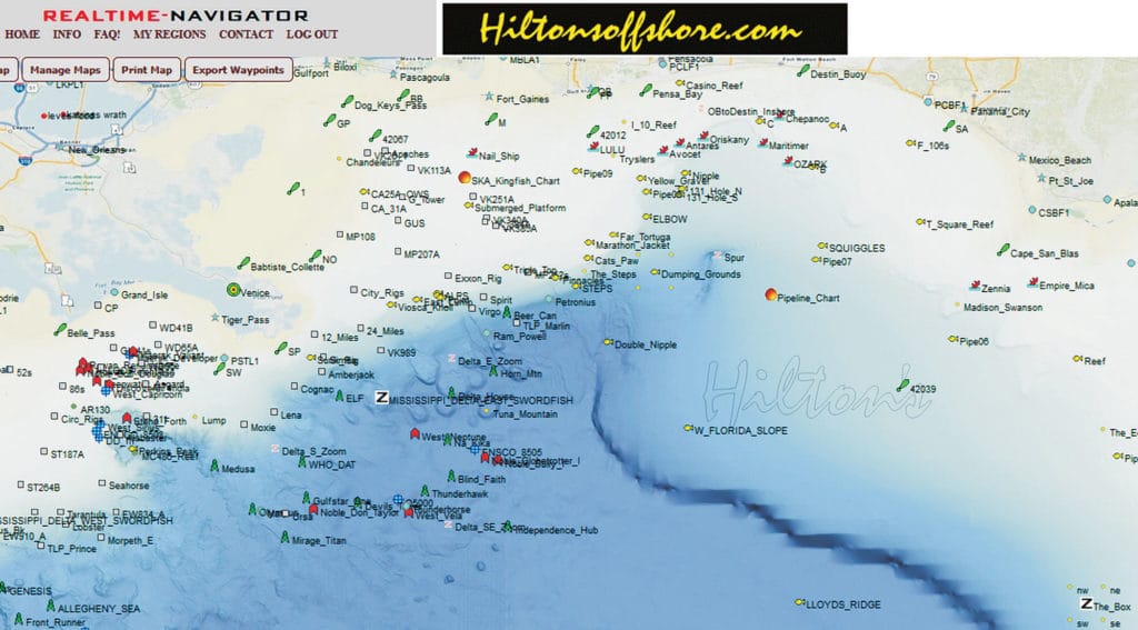
Services: Hilton’s Realtime-Navigator
Boat: No Compromise, 92 Viking, Port O’Connor, Texas
Tournaments: Western Gulf of Mexico events such as Lone Star Shootout, Texas International Fishing Tournament
“I have been using Hilton’s since 2007. I think to be able to identify areas offshore before you leave the dock is crucial to success. Time is of the essence, so you don’t have time to be fishing unproductive waters. Also, operating sport-fishing yachts is very expensive, so wasting fuel by fishing unproductive areas is not an option.
“In the past, I have utilized Hilton’s and ROFFS, but over the past couple of seasons, I have learned to extrapolate all of the data that my team needs exclusively from Hilton’s. I use Hilton’s all year long so that when tournament season rolls around, I am well aware of potential areas that overlap the most favorable conditions for offshore pelagics.
“In the week that precedes the tournament, I check Hilton’s daily to monitor tendencies of favorable conditions such as increased upwelling trends, tracking the movement of frontal temperature breaks (probable weed lines), and color changes. I am most concerned with the optimum altimetry (-20 isotopes), with the optimum amount of current (strong), with the optimum direction of the current (one that flows over a bottom feature or around surface platforms, spars or semisubmersibles. Could be any direction depending on the structure and how it corresponds to the surrounding cartography).
“Water temperature is particularly important when fishing seams and rips. A seam or rip with a nice temperature break from one side to the other is definitely worth checking out. I feel that Hilton’s has the best resolution for sea-surface temperature and chlorophyll. Additionally, Tom Hilton’s cellphone number is listed on the site, and people appreciate being able to talk to the owner of the company. Tom will answer or return every call and explain in great detail to answer -questions regarding his site.”
Capt. Jason Buck
Services: Hilton’s Realtime-Navigator
Boat: Done Deal, 70 Viking, Houma, Louisiana
Tournaments: Primarily eastern Gulf of Mexico events
“I’ve been using Hilton’s for about 10 years. I used to use SeaView in the Pacific, but it wasn’t compatible with a Mac and Hilton’s improved and became easier to use.
“Leading up to tournament season and throughout, I look at it almost daily. Trying to constantly keep up with what is happening out there. I’m not looking at any one thing in particular; I put it all together to see if it adds up to anything. Maybe I look at currents and altimetry, possibly, at the top of the priority list.
“It’s just like any other tool. It’s not a silver bullet. It can be subject to conditions. But even if it tells you where not to go and stops you from wasting your time, it is very useful. And if conditions line up, it is possible for it to tell you exactly where to go — but don’t expect that every time you look at it.
“One example of things coming together for us was Biloxi 2015 (Mississippi Gulf Coast Billfish Classic). Everything looked right in one particular spot, and I had a lot of conviction to go there. It was a long run (more than 250 miles) so I wanted to articulate to the boss why. His response was ‘So you’re telling me we’re going to the Marlin Vortex?’ We laughed about that as we won the tournament. Tom Hilton got a kick out of the story and had koozies made for us saying ‘You know it’s a done deal when you’re in the Marlin Vortex.’”
Florida (Gulf/Atlantic)
Capt. Myles Colley
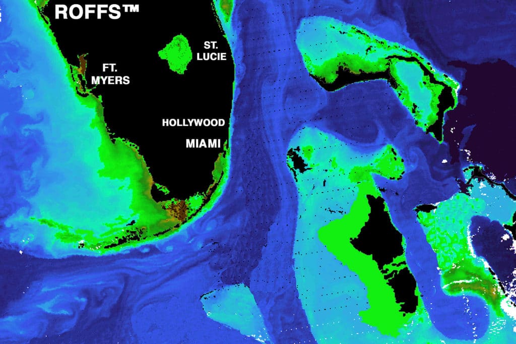
Services: Hilton’s Realtime-Navigator, ROFFS
Boat: Born2Run, 72 Viking, Pensacola, Florida
Tournaments: Cajun Canyons, Venice, LA; Mississippi Gulf Coast Billfish Classic; Emerald Coast Blue Marlin Classic, Destin, FL: Pensacola International; White Marlin Shootout, Pensacola, FL
“I’ve been using Hilton’s for about 15 years. I started using it to keep up with oil rigs. The rigs move, and Hilton’s updates the locations often. I use ROFFS also. I like being able to compare the two. ROFFS just confirms what I see on Hilton’s.
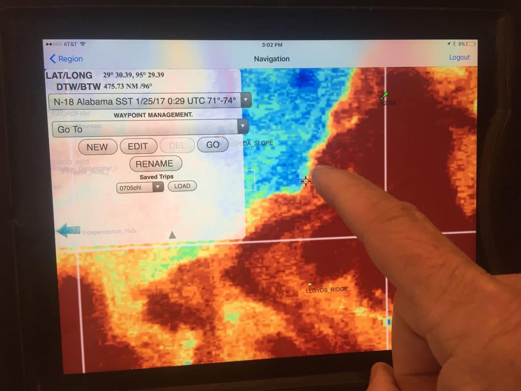
“I use the trip-planner feature when I plan a trip. It’s an easy way to calculate the total distance of the trip so I can figure my fuel burn. I look at Hilton’s daily. I like to track the way the water is moving. Some days you don’t get a great shot because of clouds, so after looking at it for a few days you can start to piece together the image. I pay the most attention to water color and altimetry.
“Water temperature is not a big factor; as long as the water is above 70 degrees, you can find blue marlin in our area. If you find blue water with good altimetry, the water temperature is going to be good as well. I don’t like to fish in the bad altimetry because most of the time it’s the loop current, which has extreme current and very little nutrients.”
Capt. Ray Rosher
Services: ROFFS
Boat: Miss Britt (three charter boats), Coconut Grove, Florida
Tournaments: Most South Florida live-bait tournaments; Bahamas, St. Thomas and Bermuda billfish events
“I’ve been using ROFFS for over 10 years. I began using it because I needed to anticipate changes in water temperature and understand current patterns.
“I like to start looking at the conditions at least three or four days in advance of the tournament so I can understand trends. One of the things I like is the feature that identifies how many days a certain condition has existed on their maps.
“The fish we’re targeting are generally sensitive to water temperature and clarity, so it’s actually pretty simple: We’re looking for that or dark-blue Gulf Stream water to push in at one end of our boundary or the other. Hopefully it’s pushed in at the middle, but most of the time we are simply trying to figure out where water conditions are improving or diminishing. That drives most of our decisions.
“Another thing I like is that the people who are answering the phones are very helpful and knowledgeable about the limitations or benefits of the shots they are providing. Honest answers are always a plus. Even if cloud cover prevents shots, they are always trying to get even a partial shot to share any information they can give.”
Capt. Tony DiGuilian
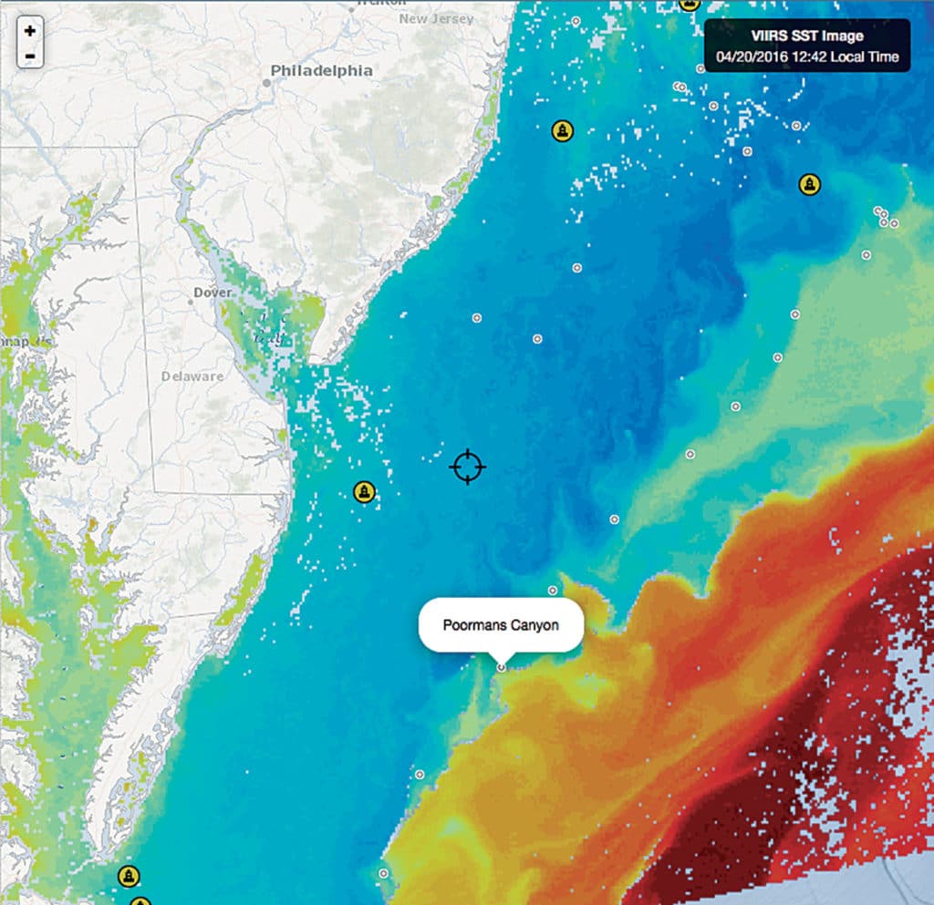
Services: ROFFS, FishTrack
Boat: Wish List, 37 Willis, Ft. Lauderdale, Florida
Tournaments: Multiple worldwide; Saltwaterproconsulting.com
“As owner of Saltwater Professional Consulting, I’m all over the world and on different boats in different locations. In South Florida, I fish with the Wish List fishing team on the sailfish circuit and in the meat-fish tourneys in the summer.
“I’ve been using FishTrack and its Buoyweather for a year; I used Hilton’s in the past, but now mostly FishTrack and ROFFS.
“When preparing for a tournament, I am checking the app at least a week prior. I will check the app at least every four hours. In south Florida I am mainly looking for sea surface temperature and temperature breaks. I also look for chlorophyll and eddies. I also try to match temperature breaks with desired topography on the bottom overlay. This is a very good feature to have access to on a smart phone.
“The best thing about FishTrack is the ease of use. I am not a tech expert and FishTrack is the easiest to learn and use. I also like that I have access to the information I’m seeking, in my pocket at all times.”
Atlantic Coast
Jon Meade
Services: FishTrack
Boats: Capt. Rich Barrett’s Shark Byte team; Showtime, 62-foot Paul Spencer, Capt. Wink Doerzbacher, Ashburn, Virginia
Tournaments: East Coast and Caribbean events
“I started using FishTrack down in the Dominican Republic a few years ago. I have also used other services such as ROFFS and Hilton’s.
“I like FishTrack since it’s easy to pull up and check on my tablet or phone. Seems like there’s always a million things to do, so being able to quickly look at how conditions have changed offshore before bed or first thing in the morning is really helpful.
“But tracking water isn’t something you just jump on a computer and do the night before going fishing. To understand what’s happening with water offshore and how it will affect your fishing you should be looking at it daily. Pay attention to currents, direction of water movement, water color, temperature, and how edges and boundaries are forming that may aggregate bait.”
Capt. John Oughton
Services: ROFFS
Boat: That’s Right, 50 Evans, Ocean City, Maryland
**Tournaments: ** Ocean City Tuna Tournament; Big Fish Classic; White Marlin Open; The MidAtlantic
“I’ve been using ROFFS for 25 years. It’s hard to find a needle in a haystack; Roffer’s has the eye in the sky.
“I use Roffer’s nearly every day while in Ocean City, Maryland, and when needed in Islamorada, Florida. I’m a charter captain, so we do fish nearly every day. I look for the eddies that have spun off the Gulf Stream from the Hudson Canyon to the Norfolk Canyon, or from Marathon to Key Largo.
“It’s very important for me to follow the movement of an eddy as it works its way inshore. The temperature, color and current both in and around the eddy are important in finding bait and fish. I look for the tight breaks and the areas that have stayed consistent. Leading edges will usually have the bait. I like to fish the southern end of an eddy and work north.
“Roffer’s is easy to use and the information that Mitch [Roffer] gives with the explanation is very helpful. Also I am able to work with Mitch himself during the day via satphone or [Delorme] InReach texting. There are those times that the water will move a great deal back offshore overnight, which then makes finding it again a chore. With Roffer’s help, we are able to relocate and get busy fishing. The most important thing I watch is movement and stability of the edges.
“Roffer’s is a great service, and to be without it would make things much tougher offshore. Also they always seem to make time to answer and help with any questions both while on land or out at sea. It has been a proven tournament-winning service year after year.”
Capt. Rich Barrett
Boat: Shark Byte, 73 Bayliss, Rumson, New Jersey
Tournaments: Casa de Campo and Cap Cana events, Dominican Republic; White Marlin Open; The MidAtlantic
“I have been using FishTrack for three years now. Our schedule takes Shark Byte to the Caribbean and the East Coast, and having the coverage in all the areas that we fish with no boundaries on the service has been a huge convenience.
“The fact that FishTrack offers combinations of selecting temperature, chlorophyll and currents gives us many of the key indicators that we’re looking for in search of the best fishing conditions to get bites. “However, just as with weather services, I use every bit of information I can gather and never rely on just one source. Most frequently, I use ROFFS [as a secondary source]. I like the personalized service [Mitch Roffer] offers and the fact that I can call for updates while fishing. We also use sites like the one for Rutgers (marine.rutgers.edu).
“I look at the service every day, and I think this is very important. Waiting for the tournament is too late. I keep up with the conditions and -indicators and how they are corresponding to the actual fishing conditions daily.
“If I have not fished, I am talking to people who did to see how the conditions and fishing were that day. I have always been fortunate to have great crew and like all the input I can get from them and everyone on board to make the best decision possible on where to point the boat when we fish. I pay most attention to fishing reports from reliable sources and captains, without a doubt.
“Sometimes areas that look like very obvious temperature breaks don’t produce, and subtle current combinations or color breaks do. It could be an area where you find rips, sulfur lines” — bacteria blooms that look like floating pollen — “or, most important, bait and actual bites that are holding the fish better.”