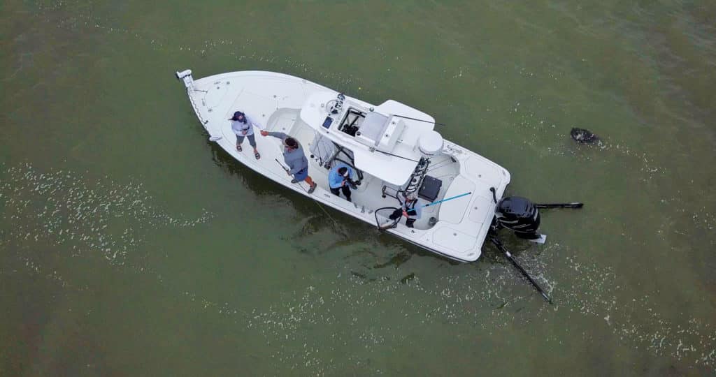
When I fish from my Hobie kayak, I’ve noticed that everything slows down. Not only is my speed diminished due to lack of outboard propulsion, but my expectations slow too.
I find more time to experiment with my electronics, and I’ve uncovered several key features in my multifunction display that have helped me better understand and learn about the marsh zones I fish.
Because of that revelation, I asked electronics-makers and pros, who use their MFDs daily, to describe some of the tricks that all inshore anglers can explore to improve situational awareness and fishing success.
Chart Art
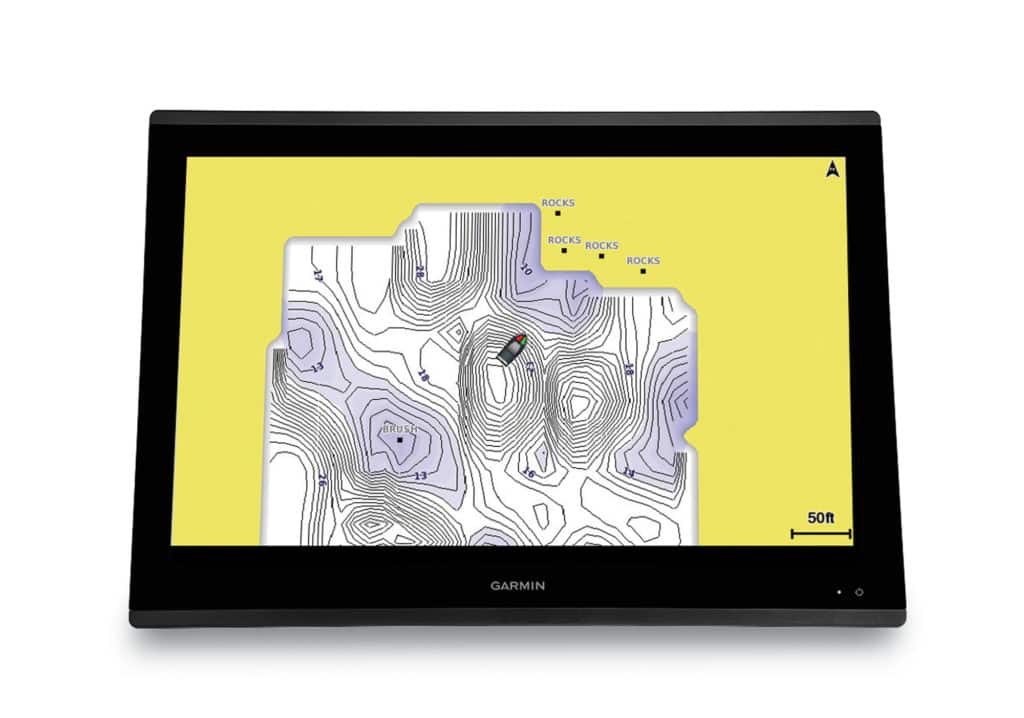
“The cartography is exponentially better now than anything we’ve had even two years ago,” says David Dunn, Garmin director of sales and marketing. “We’re also starting to see a gain in momentum for QuickDraw Contours. Every manufacturer has some form of that. I think fishermen should use that more often.”
QuickDraw Contours software and similar sonar-charting products such as Navionics Sonar-Chart Live, C-Map Genesis and Humminbird AutoChart use your boat’s transducer to update chart contours—in 1-foot increments—on a real-time basis. So, if a storm shifts the sand near your inlet, you can turn on sonar charting and see the new patterns. Regions rarely updated on official charts can be updated any given day.
On a Garmin unit, you start recording sonar with this feature through the chart page menu, choosing Layers and QuickDraw Contours. You can turn off the overlaid contours when you choose.
Dunn also recommends using depth-range shading. If you’re nearshore and looking for even a slight break in depth, you can set the chart to display one color for depths of 5 to 6 feet, for instance, and another color for depths of 6 to 7 feet.
Companies such as Standard Mapping have developed specialty charts that work with many of today’s displays. “Standard Mapping offers a map package that is 90 percent satellite photos that they have gone through to show off the shallow areas,” says Jim McGowan, marketing manager for Raymarine/FLIR.
Satellite photos really help in areas with less-than-optimal water clarity. They can identify drop-offs and points that hold fish. Be sure to set your display to show aerial photos over land and sea rather than just land. Leave at least a little transparency in the photo layer so that you can see the depths on the chart beneath, McGowan suggests.
He also advises anglers to turn on tracks each day, which will record your boat’s path on the charts. Assign a different color to each day’s track and drop waypoints when you hook up to give you a real plan for success. Know too that every waypoint is electronically stamped with depth, time and date. When turning on tracks, set up the feature to drop an electronic bread crumb every two -seconds for better continuity.
Tom Rowland, a Florida Keys captain and TV co-host of “Saltwater Experience,” uses Florida Marine Tracks as the primary inshore charting software on his Yellowfin bay boat’s Lowrance HDS Live unit. “It comes with tracks for high water or low water, and then the aerial photos on that chip are better than anything else,” he says. “You can see every little dip in the flat, see sand holes, everything.”
Sonar Tips
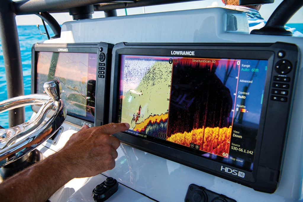
Rowland also relies on his StructureScan side-imaging sonar to scout for tarpon while he’s idling at bridges and deep channels.
“You can clearly see the fork of the tail and the shape of the fish,” he says. “The other thing we’ll do is anchor in a channel for tarpon. That has been the best for me in terms of when I’m not seeing any fish rolling and thinking of leaving. Then, I see them swimming next to us on the sonar, and that makes me stick around till the bite turns on.”
In circumstances when you don’t need to see the water column on both sides of the boat, Raymarine’s McGowan suggests selecting an option on your display to show only the left side or the right side. “It makes the presentation bigger. You get more pixels in the display, so it’s better resolution,” he says. “When you’re trying to see greater distances, the targets will look bigger.”
Even in just a few feet of water, Raymarine SideVision can look out 50 to 70 feet, he adds.
When setting a range for SideVision, McGowan eyes the distance to the shoreline or structure, then sets the range so that he sees the edge of the structure. Raymarine’s new Element series of MFDs also offers HyperVision, a higher-frequency imaging sonar that offers even greater detail, though at shorter distances.
Capt. Eric Davis (verobackcountryfishing.com), who runs a Pathfinder 2500 Hybrid out of Vero Beach, Florida, uses the LiveScope real-time sonar on his Garmin GPSMap 8612xsv to see bait schools ahead of his boat when scouting in channels, inlets, off the beach or offshore. “It’s an absolute game changer,” he says. “It mostly applies in the mid-range depths of 20 feet or more.
“I’ve literally moved up to a school of bait, looked at the screen, and said ‘Get ready, we’re going to get hit.’”
He mounted his LiveScope transducer on the transom rather than on his trolling motor because he often uses the sonar when he’s moving at up to 8 mph. He also peers under docks and at different structure, setting LiveScope to look forward on the auto setting.
Read Next: Choose the Right Electronics for Inshore Fishing
“With LiveScope, you see what’s going on now, live,” Dunn says, adding that the most helpful feature of LiveScope that he has seen is echo trails. “Even if you don’t see the fish on the screen, with echo trails on, you can see that something did just swim through.”
Regardless of the brand of electronics you use, the best rule of thumb—inshore and offshore—is: experiment.
Don’t stick with the status quo. You want more fish? Use the incredible electronic tools and information right at your fingertips.