The winner of 2021-2022 IGFA Great Marlin Race has been announced by the Florida-based fish conservation group.
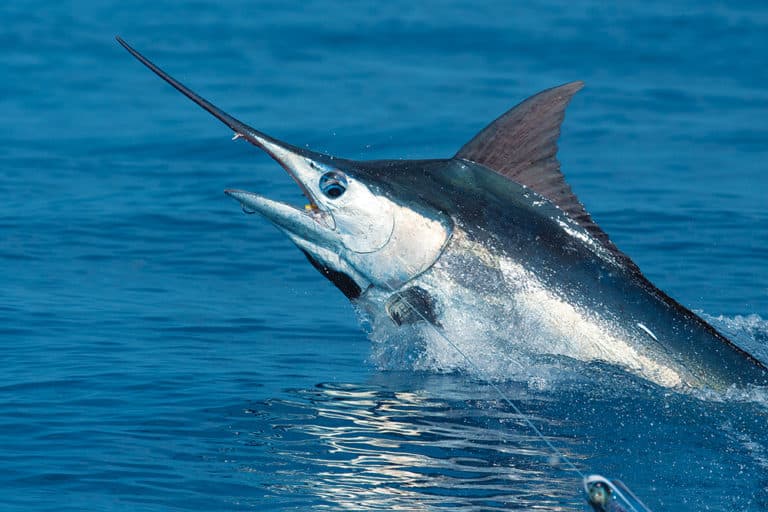
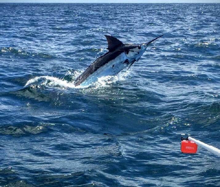
The top long-distance marlin in the IGFA race is a billfish caught by angler Andrew Brady that traveled nearly 8,000 miles over the course of its 240-day tracking. The marlin twice crossed the Atlantic Ocean.
The incredible distance the fish traveled was documented by a satellite tag, sponsored by Tony Huerta of the Lo Que Sea, and deployed on the estimated 300-pound blue marlin tagged and released during the June, 2021 Big Rock Blue Marlin Tournament in Morehead City, North Carolina.
The IGFA reports that the eye-opening marlin journey shows the fish leaving the coast of North Carolina toward the northeast before heading all the way across the Atlantic Ocean to the west coast of Africa.
Then the fish swam south through the islands of Cape Verde (off the central west coast of Africa) before heading back west where its satellite tag popped off about 800 miles east of French Guiana, located on the northeast coast of South America.
The satellite-tagged marlin was documented crossing the Atlantic Ocean twice, and recorded its deepest dive to over 1,476 feet.The tagged fish, however, spent the majority of its time near the ocean surface.
IGFA reports 19 different satellite tags were fitted to marlin during the 2021-2022 Race.Those tagged fish documented 2,264 days of tracking information, covering 15,471 miles, from tag deployment to pop-up tag location recorded by satellite GPS monitoring.
The annual IGFA Marlin Race ended Sept. 30, 2022, and over the past year the organization deployed 27 satellite tags on billfish around the world.Tags were deployed on marlin for the first time off the Dominican Republic, Ocean City, Maryland, and in the Gulf of Mexico off Alabama.
The IGFA Great Marlin Race uses linear distance (deployment to pop-up locations) to determine the annual winners from exact GPS fixes. Fish locations used to measure total distance are compiled by complex models used by Dr. Barbara Block of Stanford University. Block’s research team at Stanford factors in a variety of information about the time, day length, sea surface temperature, depth and other factors of the far-ranging marlin.
IGFA and Stanford pairs billfish anglers with cutting-edge science to learn about billfish in open ocean habitats. Fitting pop-up satellite tags on billfish at fishing tournaments around the world helps scientists understand the distribution, population, and biology of marlin.
Migration routes of tagged billfish can be viewed via satellite-enabled maps on the IGFA website, which displays billfish tracks and tag pop-up locations.