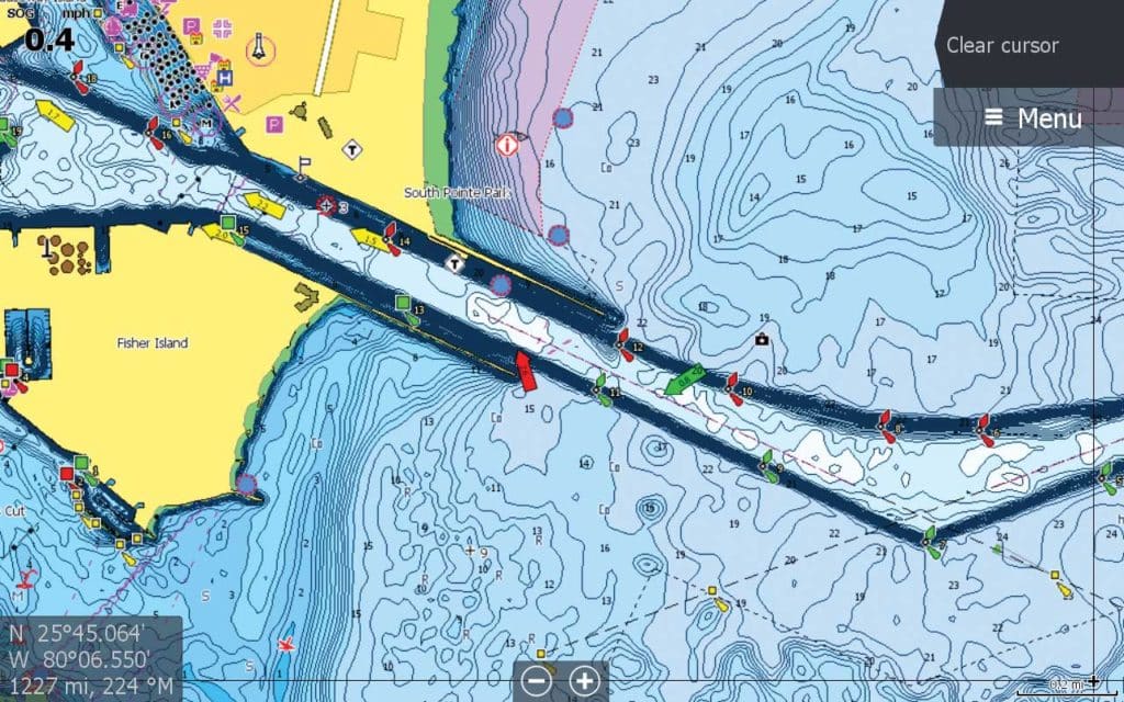
C-Map has released a new feature — Coastal High Resolution Bathymetry — for its chart cards, offering anglers the highest-resolution, most detailed contour data available. Combine that with custom depth shading, available on all Simrad and Lowrance chart plotters, and the view is further enhanced. Coastal HRB comes with new MAX-N+ chart purchases ($199 for local charts and $339 for wide) from data version v42 for most of the U.S., Bahamas and Hawaii. When navigating, anglers can turn off the layer for a cleaner look.