Within the realm of weather forecasting for fishing on the high seas, one caveat supersedes all others: Rely only on marine weather reporting. The conditions you might experience on land — or on “the hill,” as it’s sometimes called — often vary drastically from conditions well offshore.
For coastal fishing, this is not such a strong caveat. But winds can be more powerful nearshore compared with on land, and tides certainly have an effect on everything.
What you choose as your marine-weather source can make all the difference in ensuring a safe, fun day on the water. That source can also provide incredible data specifically for finding fish, such as sea-surface temperature and tide and current information.
Weather-source options include the old standby, NOAA’s marine weather radio, plus much newer technology in the form of apps for smartphones and tablets, Raymarine’s Theyr GRIB Viewer, PC-based weather software and services, and SiriusXM’s satellite marine service.
Apps, Software and Satellites
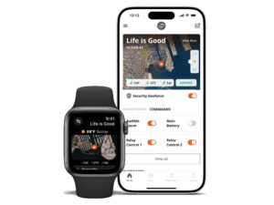
Apps such as Buoyweather and AccuWeather Marine Weather, along with GRIB Viewer, an embedded service within the most recent Raymarine LightHouse II software update for multifunction displays, depend on a Wi-Fi or cellular-phone connection. Their use is therefore limited to zones where connectivity exists. They can be excellent sources of weather information before you leave the dock and anywhere you might boat within that range of service.
Many mobile-device apps are free or cost just a few dollars, but they can be somewhat limited in their capabilities, and they display on a fairly small screen apart from your onboard electronic charts.
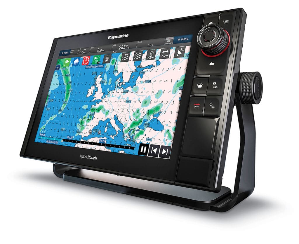
Theyr’s marine-weather service for Raymarine’s Viewer costs $14.99 a month (or $99.99 a year), requires no additional hardware, and offers detailed marine information, including wind and wave data, barometric pressure, sea-surface temperature and Nexrad radar — and all of that worldwide. It also displays on any and all Raymarine multifunction displays aboard.
NOAA’s weather radio works within the range of your VHF, which depends on the type of radio and antenna you use and can amount to as much as 20 miles. It’s also limited to brief zone forecasts.
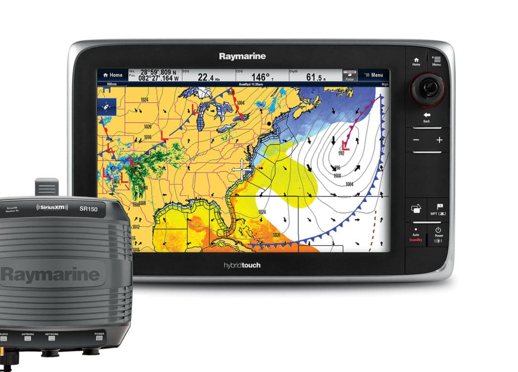
For dynamic, visual information well offshore, SiriusXM’s satellite weather service offers a robust option. (Several PC-based software programs offer weather information, but require a costly and slow connection via an expensive satellite antenna.)
Anglers can also use radar to see weather activity approaching. But while you can track those systems, you receive no other information about them.
Getting Sirius
SiriusXM works with most major marine-electronics hardware companies, such as Raymarine, Furuno, Simrad and Garmin, to create solutions that network with your onboard multifunction display.
To connect SiriusXM to your electronics, you usually need a receiver, which can come in the form of a black-box computer plus an antenna, or as a combination antenna/receiver. The receiver pairs with your brand of multifunction display and typically costs $700 to $800. With the hardware installed, you need a monthly subscription ($29.99 for coastal; $54.99 for offshore), which can include marine weather only or, for an additional fee, more than 140 channels of SiriusXM radio.
Activation costs $25 and is as simple as providing your receiver number to Sirius, which sends a wake-up signal.
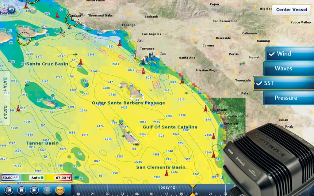
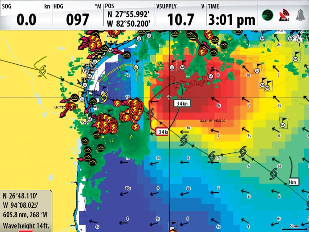
The Marine Offshore package includes a long list of data, including graphical weather radar; cloud-to-cloud and cloud-to-ground lightning; high-resolution coastal and offshore wave heights, direction and intervals; high-res sea-surface temperatures; pressure isobars; text forecasts; extended and tropical forecasts; buoy data; and even roadside fuel prices.
Lightning Strikes
“Our number one client is definitely the offshore fisherman,” says Dan Dickerson, senior manager for SiriusXM aviation and marine services. “He is going to use every tool in the toolbox to get to fish faster. Behind that is a mix between the coastal cruiser and coastal fisherman.”
The most critical piece of SiriusXM information for all boaters, Dickerson says, is what kind of front is coming toward them and at what clip. “Captains will come to boat shows and tell us how many times the service has saved their bacon,” he says.
Other hidden gems include lightning reports. “Most of our hardware providers have allowed anglers to set up a guard zone, so if lightning strikes within 5 miles, you’ll know,” says Dickerson.
Lightning is detected by a ground base station and updated every five minutes. Wind predictions can be more difficult because real-time information requires a sensor, something not available everywhere on the water. Meteorologists use computer models to crunch the data. SiriusXM also provides storm-cell attributes that detail the speed and direction of a storm cell. “You will know if it’s going to miss you to the north or south. It’s a more intense look at what you need to stay away from or be prepared for,” Dickerson says.
Display resolution for data such as wind, waves and sea-surface temperature continues to improve. Atlantic and Pacific pixel resolution can be as great as 1 kilometer by 1 kilometer per pixel.
Due Respect
With SiriusXM displaying on a plotter, you can also overlay a variety of data. You can look at wave heights, pressure isobars, wind direction and sea-surface temperature simultaneously while you track ongoing storms — above your favorite charts. And you can do this throughout North America and parts of the Caribbean.
Dickerson says feedback from captains will likely result in additional weather- and ocean-data offerings in the future. “For instance, chlorophyll is not something we have at this time,” he says. “We would like to put that out there because that’s what fishermen want. But I can’t share many details right now.”
Depending on your boat and fishing style, choose a weather source that gives you the best real-time information. And most importantly, heed the warnings that the source provides.